Hiking & Rambling -this page aims to help you assess whether a particular book of walks has the right walks for you, i.e where do the walks go; are they circular, how long are they, what maps are needed?
Slightly Better Books recommends Altberg Boots and Bridgedale socks(also to be found on Amazon UK)
Special Feature: A new page is being constructed on how to walk Hadrian's Wall from East to West based on an itinerary successfully planned and walked by the owner of Slightly Better Books. Fancy the challenge of walking 86 miles (with daily stops at lovely B&Bs and lots of cooked breakfasts, wonderful food and great beer along the way? - Take a look at The Hadrian's Wall Itinerary
In Pictures:
****Hyperlinked titles will take you to our copy on sale or prebuilt searches of copies on sale****
1994, Goose Lane Editions, pbk
Sorry, sold out, but click image above to access prebuilt search for this title on Amazon UK
Alternative online retailers to try:
Click here to access our prebuilt search for this title on Abebooks
Or click here to access our prebuilt search for this title on Alibris
Or click here to access our prebuilt search for this title on Ebay
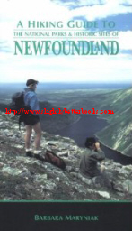
A Hiking Guide to The National Parks & Historic Sites of Newfoundland[top]
Written by
Barbara Maryniak
First published in 1994 in Canada in paperback by Goose Lane Editions, 319pp, ISBN 0864921500
PLEASE NOTE: This book may be out of date in terms of opening times, telephone numbers, accommodation and road layouts, etc, but there will be much information contained that remains relevant.
ALL the trails in this book are designed to be day hikes. The author advises walkers to buy the topographical maps on Gros Morne and Terra Nova National Parks. The Parks themselves sell these. These should be carried at all times
About this book:
Where in the world can you hike through three UNESCO-recognized sites and up a mountain that confirms the theory of continental drift? In Newfoundland, of course. Barbara Maryniak's bestselling guide is a wonderful resource for exploring more than 50 hiking trails on the island of Newfoundland. Designed for both the novice and the experienced hiker, this guide contains detailed information on the length, difficulty, estimated hiking time, conditions and distinctive features of each trail. It also includes maps, a bibliography, an index, and historical and geological vignettes. It is aimed at getting readers to discover the gems in Newfoundland's rocky crown and the best way to do this is get out and explore.
The book gives detailed information on how to prepare for going on the walks - what to take, what to wear and what to expect of the weather, including when the seasons start and end. It talks about footwear, emergency supplies, blackflies, mosquitoes, food, and water and windproof clothing; to mention just a few of the essentials.
Each park has its own introduction (for the historic sites, the introduction is primarily historical), at the end of which, there is a brief section entitled 'How to Get There' that features information on driving times and distances. This is followed by a longer section called 'Useful Information' that offers a variety of information on accommodation, shopping, hours of opening, telephone numbers etc. Each park or site is accompanied by an overall map showing the trails and Gros Morne and Terra Nova have additional maps of trails. Each trail has its own section with a quick reference at the start giving times/distances, difficulty, trail condition, a short summary, how to get to the start of the trail and a detailed trail log with times against which you can measure your own progress. A section at the end includes points of interest on the trail such as abandoned settlements, mills, shipyards, ancient volcanic rocks, moose territories, etc. A bibliography at the back will help those interested in Newfoundland indulge there interest in further works about the area.
The author writes that the two National Parks: Gros Morne and Terra Nova are very different from one another with Terra Nova consisting of a gentle landscape of rolling hills covered in coniferous trees backed by deep inlets of still, blue waters. Nearly a third of the park is covered by water and in three places, seawater reaches deep inland. Caution must be exercised by walkers as there are various ponds throughout the forests, not forgetting the bogs and fens. Ornithologists will enjoy the bird life in the estuaries and tidal salt marshes with eagles common and terns protected from marauding gulls. Along the more sheltered coastline of Bonavista Bay, the weather is milder: gentler winds and stronger sun. The trails here are mostly easy and the area much more oriented towards the family; something which is evident in the camping grounds
If you're after wild and untamed, harsh, rugged, dramatic and beautiful scenery, then Gros Morne is the park for you; the scenery can be quite varied- there are domesticated and pastoral parts with a long coastline of desolate cobble beaches full of driftwood and debris from the violent sea drenching and scouring the shores on its Western boundary. There are incredible fjords cutting vertical clefts into the start plateaus of the Long Range Mountains. Dense, coarsed grained igneous rocks colour the Tablelands a warm orange-red colour. Some trails in this park are (as you can probably guess from this description) more strenuous with steep climbs to vantage points overlooking deep landlocked fjords; whilst other walks are gentle ambles around tranquil ponds; where beavers may be evident in the dusk going about their business with determination. The mix of visitors to this park are families, senior citizens and the more adventurous and dedicated backpackers bent on having a wilderness experience and a challenge. There are longer hikes in Gros Morne (longer than a day) that an adventurous walker could start out on, but they are not covered in this book.
Gros Moren National Park
Features a map of the area on pages 40-41
The Gros Moren Trails are these:
Gros Morne National Park Trails At A Glance
Location of Walk
(in order of map location within the book)
Time (hr:mins)
Distance Km/Miles
Difficulty
Shallow Bay
45
3km/1.8 miles
Easy
Shallow Bay Detour 1
5
250m
Easy
Shallow Bay Detour 2
3
200m
Easy
Cow Head
45
3.25km
Easy
Broom Point
1:30
5.5/3.3 circular
Easy
Broom Point Detour
0:15
750m
Easy
Western Brook Beach
1:05
4.25/2.6
circular
Easy
Western Brook Pond
Boat Tour
0:35
3/1.8
Easy
Stag Brook
1:0
4.5/2.7
Easy
Snug Harbour
1:45
7.6/4.6
Moderate
North Rim Ascent
4:30
12.5/7.5
Very Strenuous
Green Point
1:10
5.25/3.2
Easy
Bakers Brook
0:40
3/1.8
Easy
Berry Head Pond
0:35
2/1.2
Easy
Berry Hill Pond
0:30
1.8/1.1
Easy
Berry Hill
0:25
1.3/0.8
Strenuous
Baker's Brook Falls
1:15
4.8/2.9
Easy
Lobster Cove Head
0:50
2.75/1.7 circular
Easy
James Callaghan
5:15
18/10.8
Very Strenuous
Southeast Brook Falls
0:05
500m
Easy
Lomond River
1:10
4.75/2.9
Moderate
Stuckless Pond
2:40
10/6 circular
Moderate
Stanleyville
0:40
2/1.2
Moderate
Lookout Hills
1:40
5.75/3.5
Moderate
Big Lookout
2:50
6.5/3.9
Very Strenuous
Tablelands Shoal Brook Road
1:20
5.4/3.2
Moderate with a strenuous return
Winter House Brook Canyon
3:25
9.25/5.6
Very Strenuous
Green Gardens Trail 1
1:10
4.5/2.7
Strenuous
Green Gardens Trail 2
5:30
15.5/9.3
Very Strenuous
Trout River Pond
1:45
7/4.2
Moderate
Terra Nova National Park Trails At A Glance
Location of Walk
(in order of map location within the book)
Time (hr:mins)
Distance Km/Miles
Difficulty
Green Head Cove
0:40
2.25/1.4
Moderate
Malady Head
0:45
2.25/1.4
Moderate
Louil Hills
1:10
5/3
Easy (except for short spur)
Southwest Brook
0:35
2/1.2
Easy
Blue Hill Pond
0:50
3/1.8
Easy
Boundary (Blue Hill West)
1:05
5/3
Easy
Buckleys Cove
1:00
4.8/2.9
Moderate
Inner Newman Sound - Trail 1 (Coastal Trail)
1:10
5.5/3.3
Easy
Inner Newman Sound - Trail 2 (Coastal Trail)
0:30
2.5/1.5
Moderate
Newman Sound Campground
1:30
6/3.6 circular
Easy
Outport (excludes Mount Stamford)
5:20 (+2:30 for boat trip)
18.5/11.1 circular
Strenuous
Detour to Mount Stamford
0:30
1.5/.9
Strenuous
Mount Stamford
3:00
10.5/6.3
Strenuous Spur
Puzzle Pond
1:55
7.8/4.7
Easy; moderate return
Ochre Hill
2:00
8.25/5 circular
Moderate
Sandy Pond
0:45
3/5
Easy
Dunphys Pond
1:15
4.75/2.9
Easy
Twin Rivers
0:10
800m
Easy
Walking in Canada
Canada National Parks
Newfoundland
2008, Countryside Books, pbk
Alternative online retailers to try:
Click here to access our prebuilt search for this title on Abebooks
Or click here to access our prebuilt search for this title on Alibris
Or click here to access our prebuilt search for this title on Ebay
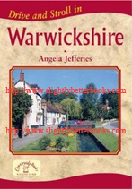
Drive and Stroll in Warwickshire [top] Written by Angela Jefferies, a retired teacher who has lived in Warwickshire for most of her life. An enthusiastic walker, she has led her local church walking group for the last 20 years (up to 2008, when this was published)
First published in 2008 in Great Britain by Countryside Books, 96pp, ISBN 9781846740718
Gives critical details such as distance, time, OS map, grid reference starting point and terrain you can expect
Gives information on key places of interest near the walk (in some places e.g. Stratford-upon-Avon, there are too many to list) and also on the pub that each walk stops at, e.g. description, what the staff are like generally, serving times for food, examples of their menu and a telephone number. A very useful guide
About this book: On a fine day, it's one of the ultimate pleasures to get in the car, drive to the country and take a leisurely walk round the glorious British countryside stopping at a good local pub or café for lunch, coffee, cream teas or dinner! Warwickshire is an ideal place for doing just this with not just its sheer beauty going for it, but the historical attractions also.
In this book are 20 circular walks varying in length from 2.5 to 5.5 miles and some of them take in very pretty places such as the lovely village of Easenhall with its cottages, barn and village green; or there's the Shuckburgh Estate with its varied landscape and stunning views ; the romantic ruins of medieval Kenilworth Castle; Aston Cantlow where Shakespeare's parents are said to have been married; Compton Verney House with its landscaped gardens; and the delightful village of Ilmington, said to be the loveliest village in Warwickshire. Some of the walks offer the chance to stroll beside rivers, canals and reservoirs; why not also follow the walks that visit the nature reserves and which are a haven for wildlife; and explore nearby places of interest.
2002, The Hobnob Press, hbk
In stock, click to buy for £3.99, not including postage and packing (£2.80, Amazon UK's standard UK charge)
Alternative online retailers to try:
Click here to access our prebuilt search for this title on Abebooks
Or click here to access our prebuilt search for this title on Alibris
Or click here to access our prebuilt search for this title on Ebay
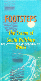
Footsteps: The Cream of South Wiltshire Walks [top]
Edited by John Chandler
First published in 2002 in Great Britain by The Hobnob Press in hardback, 124pp, ISBN 0946418101. Cover design by Dave Cousins
Published in 2004 in Great Britain by The Hobnob Press in paperback, 124pp, ISBN 0946418306
Contains maps, grid references, plates (b&w) and illustrations
About this book: The solitude and desolation of chalk downland, the timeless antiquity, the serenity of rivers in their wooded valley, intimate villages of greensand and thatch, ancient churches, pubs and paths- walking in South Wiltshire cannot fail to invigorate and delight! This is a book by local writers and walkers who all know these landscapes well, and who have been exploring and studying them for many years. They were invited to choose and describe their favourite walks, and then to enthuse about their history, literature, geology, wildlife, archaeology - whatever is their particular interest. Walk instructions are printed in bold type in numbered paragraphs and they give grid references, so you can check your course if you are worried you've strayed from the path! The numbered paragraphs each correspond to the numbers on the accompanying sketch maps. These maps are schematic only, and walkers are strongly advised to refer to the relevant Ordnance Survey maps (the editor here advises buying the 1:25,000 series), for which the sheet numbers are given in the headings of each walk. Between the instructions are paragraphs of description, photographs, and shaded boxes that give condensed information about specific topics. There are also suggestions for further reading.
Before setting off on these walks, we recommend that you check the weather forecast and the opening times of the pub (in fact whether it is still open...)
#
Walk
Written by:
Circular/
Linear?
OS Map
Miles / Km Extendable to
Miles / Km
Pub Suggestion
1
An Infant River: Stourhead, White Sheet Hill and Mere
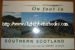
Contents: Presenting 40 of the finest walks in the Southern Uplands, On Foot in Southern Scotland is the long-awaited guide to this neglected area. Within Southern Scotland, a vast region which spans the breadth of Scotland between the Clyde-Forth canal and the English border, lie well over 200 mountains, offering a complete contracst to the rugged grandeur of the Highlands and a tempting alternative to the Lakes and the Pennines. Terry Marsh has visited every one of the mountain groups, assessing each for its value as a destination. Following this thorough research, he has chosen 40 outstanding routes that take in areas of interest and beauty and provide inspiration to those taking their first tentative steps as wall as a challenge to seasoned walkers.
Includes the walks:
Chapter 1. The Galloway Hills
The Awful Hand: Walk 1. The Merrick
Walk 2. Shalloch on Minnoch
Walk 3. Tarfessock and Kirriereoch.
The Dungeon Hills:
Walk 4. Mullwharchar by Gairland Burn
Walk 5 Craiglee and the Rig of Jarkness. The Kells Range
Walk 6. Meikle Millyea, Little Millyea and Darrou
Walk 7. Corserine and the Rhinns of Kells
Walk 8. Coran of Portmark, Meaul and Cairnsgarroch
The Minnigaff Hills
Walk 9. Loch Dee, White Laggan and Curleywee
Walk 10. Millfore and Cairngarroch
Walk 11. Larg Hill and Lamachan Hill
Walk 12. Loch Trool to Clatteringshaws. The Solway Hills
Walk 13. Cairnsmore of Fleet
Walk 14. Cairnsmore of Dee and Benniguinea via the Raiders' Road
Walk 15. Criffel
The Carinsmore Range Walk 16. Cairnsmore of Carsphairn and Benniner.
Chapter 2. The Lowther Hills
Walk 17. Lowther Hill and Green Lowther
Walk 18. Rodger Law, Ballencleuch Law and Wedder Law
Chapter 3. The Pentland Hills, Moorfoot Hills and Broughton Heights
The Pentland Hills Walk 19. The Pentland Ridge.
The Moorfoot Hills Walk 20. South Esk Watershed
Walk 21. Windlestraw Law
The Broughton Heights
Walk 22. Broughton Heights and Trahenna Hill
Chapter 4. The Culter Hills and Tinto
The Culter Hills
Walk 23. Culter Fell and Chapelgill Hill
Walk 24. Culter Watershed
The Tinto Hills
Walk 25. Tinto and Scaut Hill
Chapter 5. The Tweedsmuir Hills
The Manor Hills
Walk 26. Broad Law, Cramalt Craig and Dollar Law
The Moffat Hills
Walk 27. Hart Fell
Walk 28. The Blackhope Burn Round
Walk 29. Grey Mare's Tail and Loch Skeen
Walk 30. Mid Craig and White Coomb
Walk 31. Talla Water and Lochcraig Head
Chapter 6. The Ettrick Hills
Walk 32. Bodesbeck Law
Walk 33. The Ettrick Round
Walk 34. The Bodesbeck Ridge
Walk 35. Loch of the Lowes and St. Mary's Loch
Walk 36. From Ettrick to Yarrow
Chapter 7. The Cheviot Hills
Walk 37. The Cheviot
Walk 38. The Schil
Walk 39. Windy Gyle
Walk 40. Mozie Law, Beefstand Hill and Lamb Hill
Bibliography; Index
Hardcover:
Paperback:
Other titles of interest:
Highland Walks:
2003, S. B. Publications, pbk
Sorry, out of stock, but click image above to access prebuilt search for this title on Amazon UK
Alternative online retailers to try:
Click here to access our prebuilt search for this title on Abebooks
Or click here to access our prebuilt search for this title on Alibris
Or click here to access our prebuilt search for this title on Ebay
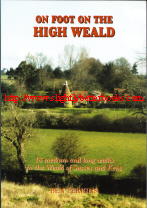
About this book:About this book: Extending westwards from St. Leonard's Forest, near Horsham, the High Weald Area of Outstanding Natural Beauty embraces some of the finest unspoilt countryside in south-east England, an intricate landscape of river valleys and sandstone ridges which finally reach the sea on the crumbling cliffs to the east of Hastings. The 18 walks in this book, varying in length from 5 to 11 miles, are designed to be completed comfortably during a leisurely day out, allowing time to explore several delightful hilltop villages or visit some of the stately homes and historic sites which are such a notable feature of this rich landscape. Each walk description is accompanied by a sketch map and notes on points of interest and refreshment stops along the way
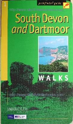
About this book/synopsis: This colour illustated book is an ideal companion for country walks in South Devon and Dartmoor - it has clear and easy to follow directions and each walk is accompanied by detailed maps from Ordnance Survey and specially commissioned photographs. It contains 28 colour-coded routes to choose from, all tried and tested by seasoned walkers and varying from extended strolls to exhilarating hikes
Walks included are:
Walk
Starts At:
Distance
Time (hrs)
Ashburton & Whiddon Scrubs
Ashburton
5.5
3
Beer and Branscombe
Beer
6.5
3.5
Bench Tor
Venford Reservoir
2.5
1.5
Bolt Head and Salcombe Estuary
North Sands, Salcombe
6
3.5
Brixham and Churston Point
Brixham
6
3
Broadhembury
Broadhembury
5
2.5
Buckfastleigh Moor
Holne
10
6
Cockington Valley
Cockington
3
1.5
Dart Estuary and Dartmouth Castle
Little Dartmouth
3.5
2
Dittisham, Cornworthy and Tuckenhay
Dittisham
9.5
5
Exe Estuary and Exminster Marshes
Powderham Church
5.5
2.5
Gara Rock and Portlemouth Down
Mill Bay
3.5
2
Loddiswell and the Avon Valley Woods
Loddiswell
5.5
3
Otter Estuary, East Budleigh and Otterton
Budleigh Salterton
6.5
3.5
Prawle Point and Woodcombe Point
Prawle Point
5.5
3
Princetown, Dartmoor Railway and Leather Tor
Princetown
10
5
Rippon Tor, Pil Tor and Buckland Beacon
Cold East Cross
6.5
3.5
Sidmouth, Salcombe Regis and Weston Combe
Sidmouth
8
4
Silverton and Christ Cross
Silverton
4.5
2.5
Start Point and Hallsands
Start Point
6.5
3.5
Stover Country Park and the River Teign
Stover Country Park
5
2.5
Three Reservoirs Walk
Bullaton Cross picnic site
6
3
Torcross, Slapton Ley and Stokenham
Torcros
7
3.5
Venn Ottery Common
Tipton St. John
5
2.5
Vixen Tor and Pew Tor
West of Merrivale Bridge
4
2
Widgery Cross and Great Links Tor
Car Park off A386
6.5
3.5
The Yealm Estuary
Noss Mayo
4.5
2.5
Yes Tor and High Willhays
Okehampton Moor Gate
6
3.5
Other books on walking in South Devon:
2008, Pitkin Publishing, pbk
Sorry, sold out, but click image to access prebuilt search for this title on Amazon
Alternative online retailers to try:
Click here to access our prebuilt search for this title on Abebooks
Click here for our prebuilt search for any edition of this book on Alibris
Or click here to access our prebuilt search for this title on Ebay
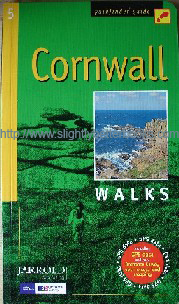
Pathfinder Guide 5: Cornwall Walks[top]
Including GPS data and new Ordnance Survey open access land mapping
Compiled by John Brooks and Sue Viccars
First published in 1990 in Great Britain by Jarrold Publishing in paperback
Reprinted in 1991, 1993, 1996, 1998, 2000, 2002, 2003, 2006
Reprinted in 2008
in Great Britain Pitkin Publishing/Jarrold Publishing, 96pp, ISBN 9780711749818
About this book/synopsis: This glossy, colour, well presented and easy-to-read guide includes information on parking, refreshments, start points, length of walk, Ordnance Survey map numbers and whether easy, moderate or challenging. Includes maps and photos
Walks included are:
Walk
Starts At:
Distance
Time (hrs)
Chun Quoit, Pendeen Watch and Botallack
Carnyorth
8
4.5
Dizzard Poin, St. Gennys and Millook Water
Cancleave
7.5
4.5
The Dodman, Gorran Haven and Portmellon
Caerhays Beach
11
6
Efford Down and the Bude Canal
Bude
5
2.5
Falmouth Bay and the Helford River
Maenporth Beach
5
2.5
Hawker Country - Morwenstow and Marsland Mouth
Morwenstow
4.5
3
Helford, Little Dennis and Manaccan
Helford
4
2
Lamorna, St. Loy's and the Merry Maidens
Helford
4
2
Land's End and Nanjizal from Sennen Cove
Sennen Harbour
4.5
3
Lerryn and St. Winnow
Lerryn
4.5
2
Little Petherick Creek, Dennis Hill and the Camel Trail
Little Petherick
6
3
Lizard Point, Kynance Cove and Cadgwith
Lizard Point
8
4
Looe, Kilminworth Wood and Talland Bay
Entrance to Kilminworth Wood, West Looe
7
3.5
Men-an-tol, the Nine Maidens and Lanyon Quoit
Bosullow
3.25
2
Mount Edgcumbe, the Sound and Cawsand
Cremyll
6
3
Mylor, Restronguet Creek and the Pandora Inn
Mylor Bridge
3.75
2
Polkerris, Readymoney Cove and Gribbin Head
Polkerris
6.5
3
Polruan and Lanteglos
Polruan
4
2.5
Porthcurno, Porthgwarra and St. Levan's Church
Porthcurno
4
2.5
Portloe and Veryan
Carne Beach, near Veryan
7
3.5
Prussia Cove and Cudden Point
Perranuthnoe
4.5
3
Around St. Agnes
Trevaunance Cove, St. Agnes
5.5
3
St. Anthony Head and St. Mawes Harbour
Porth Farm
5.5
2.5
Stepper Point from Trevone
Trevone Bay
7
3
Tintagel, Boscastle and St. Nectan's Glen
Tintagel
9
5
Trebarwith and Delabole
Trebarwith Strand
9
5.5
West Pentire, the Kelseys and Holywell Bay
West Pentire
4
2.5
Zennor to St. Ives by the Coffin Path
Zennor
8.5
4.5
Older Pathfinder Guide:
Other books on walking in Cornwall:
2008, Jarrold Publishing, pbk
In stock, click to buy for £6.25,not including p&p
Alternative online retailers to try:
Click here to access our prebuilt search for this title on Abebooks
Click here for our prebuilt search for any edition of this book on Alibris
Or click here to access our prebuilt search for this title on Ebay
Pathfinder Guide 54: Hertfordshire and Bedfordshire Walks[top]
Written by Brian Conduit; Fully Revised by Deborah King
First published in 2003 in Great Britain by Jarrold Publishing in paperback
Revised and Reprinted in 2008 in Great Britain by Jarrold Publishing in paperback, 96pp, ISBN 9780711749856
The 2008 fully revised edition includes GPS data and new Ordnance Survey open access land mapping
About this book/synopsis: This glossy, colour, well presented and easy-to-read guide includes maps, information on parking, refreshments, start points, length of walk, Ordnance Survey map numbers and whether easy, moderate or challenging. Includes maps and photos.
The introduction tells the walker all about the Herts and Beds landscape and geography (e.g. gently undulating countryside, low hills, quiet rivers and patches of woodland), places of historic interest (for example the mediaeval castle at Berkhamsted), literary connections and walking in the area generally.
Includes further information on the Ramblers' Association; The National Trust and the relationship between walkers and the law, e.g. rights of way, new access rights, obligations on local councils regarding rights of way, and more.
Walks included are:
Walk
Starts At:
Distance
Time (hrs)
Ampthill Park & Millbrook Warren
Ampthill
8.5
4
Around Roxton
Roxton Village Hall
3.5
1.5
Around Ashwell
Ashwell
5.5
2.5
Ardeley, Benington and Walkern
Ardeley
7
3.5
Barkway, Reed and Earl's Wood
Barkway
6
3
Bramfield Woods
Bramfield
4.5
2
Bridgewater Monument and Aldbury
Bridgewater Monument
4
2
Chipperfield and King's Langley
Chipperfield
6.5
3
Clophill Wrest Park and Silsoe
Clophill
8.5
4
Dunstable Downs and Totternhoe
Dunstable Downs Gateway Centre
5.5
2.5
Essendon and Little Berkhamsted
Essendon
4.5
2.5
Hertford and the Cole Green Way
Hertford
5.5
2.5
John Bunyan Country
Priory Country Park
7.5
3.5
King's Wood and Houghton House
Houghton Conquest
4
2
Northchurch Common and the Grand Union Canal
Berkhamsted
6
3
Odell, Great Wood and Harrold
Harrold Odell Country Park
6
3
Old Warden Park
Old Warden Park
4.5
2
Sandy and Everton
Sandy Market Square
8.5
4
Sarratt and the River Chess
Chorleywood Common
5.5
2.5
Sundon Hills and Sharpenhoe Clappers
Sundon Hills Country Park
5.5
2.5
Stockgrove Country Park
Stockgrove Country Park
3
1.5
St. Albans and the Ver valley
St. Albans
10.5
5
The Ayots, Brocket Park and the River Lea
Wheathampsted
9.5
4.5
Turvey
Turvey Bridge
6.5
3
Upper Lea Valley and Someries Castle
Peter's Green
6.5
3
Ware, Stanstead Abbotts and Great Amwell
Ware
6.5
3
Whitwell and St. Paul's Walden
Whitwell
6
3
Woburn Park and Eversholt
Woburn
8
4
2008, Revised Ed., Jarrold Publishing, pbk
2003, Jarrold Publishing, pbk
Other walks books for Hertfordshire:
2005, Countryside Books, pbk
In stock, click to buy for £3.15, not including post and packing
Alternative online retailers to try:
Click here to access our prebuilt search for this title on Abebooks
Or click here to access our prebuilt search for this title on Alibris
Or click here to access our prebuilt search for this title on Ebay
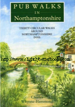
About this book: If you enjoy both walking and visiting country pubs, this book should appeal. All the inns are in Northamptonshire and surrounded by excellent walking country. Every walk begins and ends at a particular pub, where good food, as well as good ale, are served in a traditional surroundings. The routes vary from 2 to 6.5 miles and each is described in detail with its own accompanying sketch map. There are walks along riverbanks, lakesides and towpaths; through woods and valleys, over hills and watermeadows. Many of the county's prettiest villages and its most beautiful and secluded parkland are explored. There are also stretches of Northamptonshire's popular long distance footpaths including the Nene Way, the Knightley Way and the Grafton Way. All 30 pubs are described and details include opening times, specialty menus and their range of ales and lagers. Please note that this book was last reprinted in 2005 and therefore some of the information may be out-of-date. It is wise to telephone the pub or check it out on the internet in advance to make sure that it is open and serving at the required time
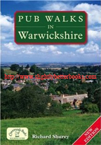
About this book: To those who enjoy both walking and visiting country pubs this book should provide much satisfaction! The pubs have been chosen for their good food, and the routes give the walker the opportunity to experience the glorious countryside of Warwickshire at its best. A bestseller from the day it was published, this collection of classic pub walks now appears in a new up-dated and revised edition. It contains 20 circular routes ranging from the ancient Forest of Arden in the North to the rich agricultural lands of the Avon and the glorious Cotswolds in the South. There are tranquil waterside walks along the banks of the river Blythe at Hampton-in-Arden and at Wootton Wawen beside the meandering river Alne; invigorating walks to Napton Hill and Brailes Hill with their superb views; and charming walks through picturesque towns and villages such as Aston Cantlow and Shipston-on-Stour. The walks vary in length from 3 - 7 miles and each route is described in detail with its own accompanying sketch map. There is a photograph of each pub and information about its history and character, how to get there, parking facilities, food specialities and range of ales.
2009, The History Press, pbk
In stock, click to buy for £5.20, not including p&p, which is Amazon's standard charge (currently £2.80 for UK buyers, more for overseas customers)
1990, Alan Sutton Publishing, hbk
Sorry, out of stock, but click image above to access prebuilt search for this title on Amazon UK
Alternative online retailers to try:
Click here to access our prebuilt search for this title on Abebooks
Click here for our prebuilt search for any edition of this book on Alibris
Or click here to access our prebuilt search for this title on Ebay
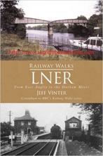
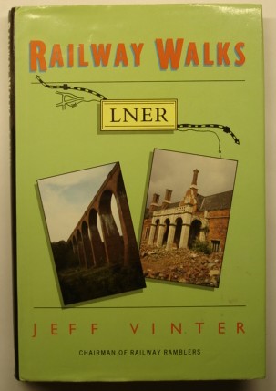
About this book/synopsis: In this volume of the Railway Walks series, Jeff Vinter looks at converted lines in the territory of the former London and North Eastern Railway. Railway closures can be traced from the 1930s, with a sudden upswell in the 1960s, when the recommendations of the Beeching report were implemented.
Fortunately, far-sighted councils such as Durham County Council stepped in promptly following the Countryside Act of 1968, purchasing a number of abandoned lines for conversion into recreational trails and maintaining the continuity of the routes. As a result, the area covered offers an extensive selection of railway walks, with County Durham a national showpiece of what can be done.
This volume describes in detail ten of the best of these walks. The lines covered range from quiet byways and holiday lines in East Anglia, to a network of abandoned industrial lines radiating from the former steel town of Consett in County Durham. Routes along the way include the splendidly scenic Scarborough and Whitby Railway path, the Hudson Way from Market Weighton to Beverley and, most remarkably of all, the Selby and York Railway Path and Cycle Route -until September 1983, part of British Rail's premier East Coast main line. The detailed description of each walk includes OS grid references, helpful maps and illustrations, and comprehensive transport and refreshments information. If the walker's appetite for more exploration has been whetted, further walks, preserved railways and museums are suggested which shed light on the area's industrial past. The 'armchair walker' is also catered for, each chapter being prefaced with a full historical description of the line and a resumé of its regeneration after closure.
Walks include:
1. The Alban Way. 6.5 miles
2. An Essex Byway. 15 miles
3. The Midland and Great Northern Joint Railway, Norfolk
Walk 1: The Weaver's Way, North Walsham to Aylsham. 7 miles
Walk 2: Marriott's Way, Attlebridge to Hellesdon. 7 miles
4. The Spa Trail. 6.5 miles
5. The Hornsea Rail Trail. 15 miles
6. The Hudson Way. 11 miles
7. The Vale of York. 7.5 miles
8. The Scarborough and Whitby Railway Path. 23.5 miles.
9. The Waskerley Way. 7 miles
10.
The Derwent Walk. 10.5 miles
Includes useful addresses; an appendix of official railway walks and an appendix of County Council Public Transport Offices
Other Jeff Vinter Books on Amazon:
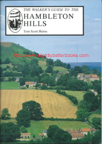
1997, Smith Settle, pbk In stock, vgc, £6.50, click image above to access prebuilt search for this title on Amazon where you can buy our copy
Alternative online retailers to try:
Click here to access our prebuilt search for this title on Abebooks
Click here to access our prebuilt search for this title on Alibris
Click here to access our prebuilt search for this title on Ebay
Click here to access our prebuilt search for this title on Biblio
About this book: The delightful, rolling Hambleton Hills, on the edge of the North York Moors, provide excellent walking country and hold many surprises: the imposing medieval remains of Rievaulx Abbey and Helmsley Castle; picturesque villages like Coxwold and Kilburn; landmarks such as the White Horse of Kilburn, Sutton Bank and Lake Gormire; and surrounding all are miles of open moorland just waiting to be explored. The best way to enjoy the region's many delights is by walking. Walker's Guides are a new kind of guidebook which bring the countryside to life, a unique combination of detailed walks together with informative descriptions of all the points of interest along the way
Introductory chapters give the background to the area: LANDSCAPE: geology; the shaping of the landscape; rock strata; the ancient environment; fossils; HISTORY: early man; Romans and Vikings; monastic times; farming and quarrying; droving; the present day; WILDLIFE: Birds; mammals; reptiles and insects; habitats; markings and behaviour; common species and favourite localities; FLORA: flowers, trees and fungi; some typical plant habitats; species to be found in the area. The book contains 20 circular walks, ranging from 5 to 12 miles, each with a) detailed route directions; b) easy-to-follow maps showing the route and nearby features; descriptions of points-of-interest along the way: flora and fauna; geology and landscape, history, industry and folklore; notes on starting points, parking, distances and walking times. The book is illustrated with a wealth of photographs, line drawings and watercolours
Contents:
Key to Maps
Introduction
Acknowledgements
Public Transport and Tourist Information Centres
Rocks and the Landscape
Man and the Landscape
Wildlife
Flora
Selected Reading
Index
#
Route
Circular Y/N
Miles
Km
1
Arden Great Moor
Y
10.5
17
2
Kepwick and Cowesby from Over Silton
Y
5.5
9
3
Limekiln House and the Drove Road from Kepwick
Y
5.5
9
4
Hawnby, Easterside Hill and Shaken Bridge
Y
7.5
12
5
Coomb Hill and Dale Town from Hawnby
Y
5
8
6
Hawnby Hill and Hazel Head from Hawnby
Y
7
11
7
Caydale and Noddle End from Murton
Y
7.5
12
8
Kirby Knowle to Felixkirk and Boltby
Y
8.5
14
9
The Drove Road and Windygill Ridge from Boltby
Y
7
11
10
Rievaulx Abbey and Caydale from Murton
Y
8.5
14
11
Old Byland to Nettle Dale and Scawton
Y
7.5
12
12
Boltby to Gormire Lake and Whitestone Cliff
Y
7
11
13
Kilburn White Horse Circular
Y
5.5
9
14
Balk and Bagby from Sutton Village
Y
7
11
15
Wass to Cockerdale and Byland Abbey
Y
7
11
16
Coxwold and Beacon Banks from Kilburn
Y
10
16
17
Shallow Dale and Ampleforth Country
Y
9
15
18
Helmsley to Harome and Sproxton
Y
10
16
19
Slingsby Castle and Fryton from Hovingham
Y
10.5
17
20
Stonegrave and Caulkleys Bank from Nunnington
Y
7
11
2008, Countryside Books, pbk
Sorry, sold out. Click on image/title to access other copies on sale at Amazon
Alternative online retailers to try:
Click here to access our prebuilt search for this title on Abebooks
Click here for our prebuilt search for any edition of this book on Alibris
Or click here to access our prebuilt search for this title on Ebay
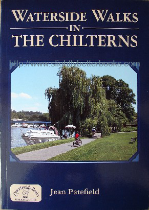
About this book/synopsis: This book is a glossy, full colour, well-presented and simple-to-use and follow format. Each walk is between 2.5 and 7.5 miles and is carefully described with information on how to get to the starting point, where car parking is located and where refreshments can be found. Telephone numbers are given for the refreshments places so you can ring ahead and check they are open or book your cream tea!
All walks are circular. They start and finish where a car can be conveniently left
Walks 2, 7, 8, 9, 14 and 17 can easily be accessed by rail
All the walks are based on at least one pub
Seven walks explore sections of the Thames, which forms the Southern boundary of the Chiltern Hills
Five walks explore sections of the Grand Union Canal, which passes through the Chilterns at Tring Gap
Six walks explore the rivers of the Chilterns, for example the Bulbourne and Misbourne
The route descriptions are broken into numbered paragraphs that correspond with numbers on the accompanying sketch maps. The relevant OS number is given for each walk.
Don't forget also the local places of interest - such as the art gallery in Cookham focused on the artist Stanley Spencer and historic Hughenden Manor, that has associations with Disraeli.
What are the Chilterns? They are an arc of chalk hills roughly 40 miles north and west of London. They cross several Shires - Berkshire, Buckinghamshire, Hertfordshire and Oxfordshire.
Contents: Includes 20 waterside walks of varying lengths:
1) Cookham and Cliveden Reach - 6 miles
2) Hedsor and Cookham Reach -5 miles
3) Little Marlow - 3 miles
4) The Thames at Medmenham - 3 miles
5) Hambledon and Aston -6 miles
6) Henley and Fawley - 7 miles
7) Goring - 7.5 miles
8) Chalfont Park and the Colne Valley - 7 miles
9) Berkhamsted - 5 miles
10) Northchurch Common and Cow Roast Lock
11) Marsworth Reservoirs - 4 miles
12) Wendover Woods and Canal - 6 miles
13) Chenies and the Chess Valley-5 miles
14) Chesham & The River Chess - 6 miles
15) Little Missenden & The River Misbourne-4 miles
16) Hughenden Valley-4 miles
17) The Source of the River Misbourne-4.5 miles
18) The Gade Valley-3.5 miles
19) Two Lakes Walk-4 miles
20) Burnham Breeches-2.5 miles
Other Chiltern Walks Books:
1986, reprint, Polecat Press, pbk
Sorry, sold out. Click on image/title to access other copies on sale at Amazon
Alternative online retailers to try:
Click here to access our prebuilt search for this title on Abebooks
Click here for our prebuilt search for any edition of this book on Alibris
Or click here to access our prebuilt search for this title on Ebay
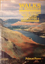
Walks to Remember: Fifteen Shorter Walks in the Northern Lake District[top]
Written and illustrated by Tony Hopkins
Photographs by Tony Hopkins and Peter Freeman
Maps drawn by Don Sargeant; other illustrations by Brian Waters; Edited by Caroline Freeman
Cover photograph: Buttermere Valley from Hay Stacks
First published in 1984 in Great Britain in paperback, 96pp, ISBN 0947688005
Reprinted in 1986. Original UK retail price: £2.95
About this book/synopsis: The Northern Lake District of England contains some of the best upland walks in Britain. The walks are famous for their views and the quality of the surrounding countryside. This book includes 15 of the most interesting shorter walks with comprehensive interpretive notes giving an insight into the wildlife, agriculture, history and landscape of the area.
There are concise, clear route descriptions, maps, photographs and drawings intended to be useful both on the day of the walk and as a momento to bring back pleasant memories.
All the walks are CIRCULAR and start from a convenient parking place and they vary in length from 1.9 miles to 5 miles (3 to 8 km). Most walks will suit a variety of ages and levels of fitness; some concentrate on lakesides and valleys, while others take the walker through steep wooded slopes or fell tops. The majority of walks require little previous walking experience
Contents:
Introduction
Selecting a Walk; Timing; Preparation and Safety; Route Descriptions; The Maps; On The Walk; 1. Latrigg; 2. Castlehead; 3. Walla Crag; 4. Naddle Valley and Low Rigg; 5. Cat Bells; 6. Newlands Valley; 7. Castle Crag; 8. Johnny's Wood; 9. Grange Fell; 10. Dock Tarn and Watendlath; 11. Stonethwaite; 12. Buttermere; 13. Hay Stacks; 14. Rannerdale and 15. Brackenthwaite
#
Walk
Distance
Ascent
km
miles
metres
miles
1
Latrigg
Spooney Lane-Latrigg-Brundholm-Windebrowe
8
5.0
270
0.17
2
Castlehead
Cockshot-Great Wood-Friar's Crag
5.5
3.4
110
0.07
3
Walla Crag
Great Wood-Ashness Bridge-Walla Crag-Rakefoot
6.5
4.0
300
0.19
4
Naddle Valley and Low Rigg
Castlerigg-St. John's In The Vale Church-Tewet Tarn
6
3.7
170
0.11
5
Cat Bells
Gutherscale-Cat Bells-Manesty Park-Brandelhow-Hawes End
6.5
4.0
370
0.23
6
Newlands Valley
Chapel Bridge-Low Snab-Skelgill-Little Town
Brackenthwaite
Lanthwaite-Brackenthwaite Hows-Crummock Water
5
3.1
150
0.09
Other Lake District Walks:
2004, Countryside Books, pbk
Sorry, sold out, but click image above to access a prebuilt search for this title on Amazon UK
Alternative online retailers to try:
Click here to access our prebuilt search for this title on Abebooks
Click here for our prebuilt search for any edition of this book on Alibris
Or click here to access our prebuilt search for this title on Ebay
Waterside Walks near Bristol & Bath[top]
First published in 1999 in Great Britain by Countryside Books
Reprinted in 2004 in Great Britain by Countryside Books in paperback, 96pp, ISBN 1853065544
. Original UK retail price: £7.95
About this book/synopsis: Water has always added that bit of extra interest and that additional scenic beauty (or sometimes starkness) and the area around Bristol and Bath is particularly fortunate in having so many waterways to explore. There are the great rivers - the Severn, the Avon and the Frome; the reservoirs which supply Bristol with its water - Blagdon Lake, Chew Valley Lake and the Litton Reservoirs; the Kennet and Avon Canal; and the Bristol Channel. The twenty circular walks in this book are all between 2-7 miles in length and they take the walker part of the way along the banks of these waterways and through some of the most beautiful scenery in England. Each walk instruction also includes details on how to get to the start, where to park, and what pub food and drink are available locally. For greater clarity, the route descriptions are divided into numbered paragraphs which correspond with the numbers on the accompanying sketch maps. There are also separate sections about places of interest nearby such as the Fox Talbot Museum of Photography in Lacock and Berkeley Castle, where Edward II met his death in 1327.
#
Walk Location:
Distance
(miles)
Map Needed-
alternatives given where possible: links to relevant map on Amazon
2001, Shoal Bay Press, pbk
In stock, click to buy for £4.75, not including post and packing, which is Amazon UK's standard charge (currently £2.80 for UK buyers, more for overseas customers)
Alternative online retailers to try: Click here for our prebuilt search for this book on Abebooks
Click here for our prebuilt search for any edition of this title on Alibris
Click here for our prebuilt search for any edition of this title on Ebay
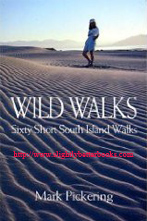
Wild Walks: Sixty Short South Island Walks[top]
Written by Mark Pickering; Photographs by Nic Bishop and Mark Pickering
First published in 1995 in New Zealand by Shoal Bay Press Ltd in paperback
Reprinted as revised editions in 1997 and 2001
2001 edition: 164pp, ISBN 0908704267
About this book/synopsis: The South Island of New Zealand is blessed with wild places and a growing reputation for nature tourism; further, many of the wild places are right under our noses. Only a short way from many of the more conventional tourist centres, you can visit rainforests, estuaries, granite gorges, beaches, windswept coasts and coastal lagoons, tussock plains and hot springs. This book describes 60 short walks, each with a landscape feature or wildlife habitat that makes it unique The 'wild' used in the title is not meant to convey the message that each walk is a little bit dangerous, but rather that the quality of the landscape is wild. It is not a book for the dedicated tramper or hiker - it is for the tourist or holidaymaker with an hour or three to spare, who likes to put on his or her walking shoes and take a short stroll into the unspoilt magic of wilderness. Native wildlife abounds in these ancient and untouched spots: little blue penguins, shags, sealions, Hector's dolphins, kakas, keas, kiwis, kereru, albatrosses...the list goes on. Many are unique to the habitat in which you will see them. The walks described range from 15 minutes to about 4 hours (return) and are suitable for people of all ages. Location maps and concise directions make them easy to find and follow. The maps are a simple visual guide to the areas and are not intended as substitutes for topographical maps. Walkers are advised to get the proper maps if they want to stray from the beaten track
Points to Note about Each Walk:
Each has a striking feature of landscape or wildlife
Many different types of habitat are represented - estuaries, rainforest, granite gorges, tussock plains, coastal lagoons, limestone outcrops or hot springs, etc
Anyone from the elderly to young children can tackle these walks - no special equipment is needed, apart from waterproofs and strong, preferably waterproof, shoes. Walkers should take food and spare warm clothes during the winter months and keep an eye on the weather; those doing the coastal walks should keep an eye on the tides
The walks are generally easily accessible and well-graded, with information signs and often toilet facilities
None of the walks takes more than four hours (return)
If you have them, take binoculars
The walking times given on each time are conservative. They are designed to cater for slower walkers and families with young children. Any adult of reasonable fitness can reduce the times considerably
Mountain bikes are not permitted on most of these tracks [note this book was published 2001, may be different now]
Some walks will only be accessible for wheelchairs for a certain distance; even on the best of walks there may be obstacles, e.g. tree roots, rocks, ditches
Some walks are closed at particular times of the year, e.g. during the lambing months of August to November. Other reasons may be fire risk or wildlife management
Walkers should keep to the tracks.
Chapters: Introduction Areas Covered: (number in brackets indicates length of walk in hours/minutes)
Nelson: Waikoropupu Springs (30),
Farewell Spit (1-2 hrs), Marahau Estuary (2-3 hrs), Flora Tableland (3 hrs to Grid Iron Gulch; 4-5 hrs return to Salisbury Hut), Pelorus Bridge (30 mins return on Totara Walk, Circle Walk or Tawa Walk), Lake Rotoiti (2 hrs), Boulder Banks (no time given)
Lewis Pass: Lake Daniells (5 mins to the Sluice Box Gorge; 3-4 hrs return to Lake Daniells), Tarn Walk & Sylvia Flats (Tarn Walk - 30 mins return; Sylvia Flats hot pools - 5 mins return)
Canterbury & Banks Peninsula: Napenape (1 hr circuit on the bush track), Scarborough Head (full circuit from Sumner to Scarborough Head to Taylor's Mistake to the Heritage Trail and back to Sumner takes 3-4 hrs), Birdlings Flat & Kaituna Lagoon (a stroll to the red cliff and back to Birdlings Flat would take an hour), Montgomery Park (for the bush and big totara tree it's about a 10 minute return; to reach the highest lookout and return will need about 2 hrs-warning the track is rough in some places), Castle Hill (2+ hrs; Cave Stream takes 1 hr), Sharplin Falls (Sharplin Falls - 1-2 hrs; Duke Knob allow 2 hrs return), Woolshed Creek Canyon (4-5 hrs return), Peel Forest Tarn (Alpine Tarn and back via Allan's Track and Fern walk allow 2-3 hrs return. Dennistoun bush walk circuit - 1 hr)
Arthur's Pass: Dobson Nature Walk (1 hr), Bealey Spur (Bealey Hut return 2-3 hrs)
Mackenzie Country & Mount Cook: Ohau Ponds & River Delta (1 hr), Clay Cliffs - Paritea (1-2 hrs), Blue Lakes & Glacier Lookout (30 mins return to Blue Lakes; 30 mins return to Glacier Lookout; 40 minutes to Terminal Outlet; to do all three, allow 2 hrs return), Sealy Tarns & Kea Point (1 hr return to Kea Point; 3-4 hrs return to Sealy Tarns)
West Coast: Heaphy Coast (Scott's Beach circuit 2 hrs return; Nikau Walk 40 mins return), Oparara Arches (Oparara Arch 30 mins return; Little Arch 2 hrs return; Honeycomb Hill Cave and Top Arch - 3 hrs return), Charming Creek (right through is 3-4 hrs - you will need transport at the other end), Cape Foulwind (30 mins return to the seal colony; 2-3 hrs one way for the entire walkway), Punakaiki/Truman Track (Pancake rocks 30 min circuit; Truman Track 30 min return), Kahikatea Forest Walk (20 mins circuit), Wanganui Headland (full circuit about 2-3 hrs)
South Westland:
Okarito Lagoon (Okarito Trig 1 hr return; Three Mile pack track to lagoon - with low-tide beach option, 3-4 hrs return), Franz Josef Glacier (to the glacier terminal lookout and back 2 hrs), Lake Matheson (1-2 hrs circuit), Gillespies Beach (to the lagoon and back 2 hrs; to the historic tunnel and lookout 3 hrs return; to the seal colony 4 hrs return), Ship Creek & Monro Track (Monro Track 2-3 hrs return; Ship Creek 1 hr return), Hapuka Estuary (30 mins return)
Otago: Graves Walkway (2-3 hrs return - one section of the walk requires low tide to get past), Shag Point (1-2 hrs), Sandfly Bay (2-3 hrs return), Tunnel Beach (2 hrs return), Sutton Salt Lake (the full circuit takes 1-2 hrs return), Roxburgh Gorge (to Coleman's Creek return allow 3-4 hrs. It is wise to carry water as it is not easy to ge through the scrub to the Clutha, and the gorge can get intensely hot in summer)
Catlin's Coast: Nugget Point (20 minutes return to the lighthouse; 15 minutes return to Roaring Bay), Cannibal Bay (the walk to Surat Bay and back takes 1-2 hrs; from Cannibal Bay to the Surat Bay road end allow 2-3 hrs), Curio Bay (1 hr)
Wakatipu & Southland: Blue Pool (30 - 50 mins return), Lake Alta (3 hrs return - fair weather and summer walk only), Bob's Cove (nature walk to Bob's Cove and peninsula lookout 1 hr return; to Twelve Mile Bluff 1 hr return; to Twelve Mile Creek Delta 2 hrs return), Mavora Lakes (3-4 hrs return around South Mavora Lake; Mavora Walkway 2-3 days. North Mavora Lake Edge 4-5 hrs return), Foveaux Walkway (2-3 hrs return)
Fiordland: Hidden Falls (3 hrs return to the 2nd verandah; 4 hrs return to Hidden Falls hut), Key Summit (2-3 hrs), The Chasm & Bowen Falls (The Chasm 20 mins; Bowen Falls 20 mins), Lake Gunn - O Tapara (1 hr circuit), Shallow Bay (2-3 hrs return to Shallow Beach)
Stewart Island: Maori Beach (3-4 hrs); Ulva Island (2-3 hrs around the island)
Other Books on Walking in New Zealand:
Maps of New Zealand:
Rough Guide NZ
Hiking, Walking and Rambling Books/Magazines on Ebay:
Hiking, Walking and Rambling Books on Amazon [please note that lack of pricing on banner does not mean book is out of stock, but that there are only secondhand copies available]


![Conduit, Brian; and King, Deborah. 'Pathfinder Guide 54: Hertfordshire and Bedfordshire Walks' [Pathfinder Guide No. 54], published in 2008 by Jarrold Publishing in paperback, 96pp, ISBN 9780711749856. Condition: Like new, unread copy. Price: £6.25, not including p&p, which is Amazon's standard charge (currently £2.75 for UK buyers, more for overseas customers)](docs/conduitbriankingdebpathfinder54hertsbedspbksbb.jpg)